History
by Jan Goffey
Much of the last 2 centuries of residential building of the town took the name of the land on which they were built. At the right hand edge of the map is the word Fern…this is in the area of the residential housing now in the aptly name Fern Meadow. Likewise, Lopes Crescent and Leaholes (or Leeholds) avenue.
Why is this important?
Because next to Lopes Meadow we see Wonnacotts Meadow, Onestone Meadow, Tuckfields, CourtsMead and Yellands. This is the area that some people refer to now as Hogs Wood because of the hedgehogs living there with an abundance of wildlife. Ancient burgage strips can be seen beyond this -
In 1899 Land adjoining Tuckfield Meadow (described as Burgage strips) was sold by Gertrude Charlotte Goodeve to Edmund Hunt Holley owner of Oaklands.
In 1911 Land part of Tuckfield Meadow was sold by OUC to Messrs Blatchford and Dawe, Builders, with a 10 foot right of way to the side of 17 Crediton Road and the 3 adjoining properties to access the rear of their houses. The same access for the four houses on the other side of Neville Road.
In 1927 E Hunt Holley sold his land to Ernest William White Bartlett and it was then conveyed in the same year to William John Avery. This is the plot beyond the end of Neville road, and runs the extent of Tuckfields Meadow. The condition of this roadway is the responsibilities of the 8 houses with access plus Avery’s Builders.
In 1938 The Non Ecclesiastical Charity sold Tuckfields Allotments (1 acre, 2 roods and 33 perches) together with the entrance road to Crediton Road subject to all rights of way to William John Avery who built their yard behind no. 27 Crediton Road. and the four ‘new houses’ were built at the end of this access road.
Within living memory, the lower end towards North Street, was a meadow where cows were kept to supply the town with milk. Huxtables dairy being on Northfield Road behind number 29. Around the time of the First War, Shobrookes who owned the corner shop, owned the first strip East to West, the middle strip was allotments and the bottom part still grazing. The sawmill was at the far bottom end of the site off North Road and was never part of this site.
After the 2nd World War, the land appeared to be owned by Mr Lias (stepfather of Mr Derek Ellis) a builder, Shobrookes, who still had the corner shop and Avery’s at the top by Crediton Road. Mr Lias built his wooden workshop at the end of what is now called Ted’s Way. (Where a house has been built) garages on the periphery for the owners of propertis in Northfield Road and the allotment holders put up their temporary sheds, greenhouses etc. This workshop is the building seen on the 1927 ? aerial photograph (OTC archive). It is a wooden shed and thus not a permanent structure.
In the 1990’s the sister of Mr Derek Ellis was contacted by a developer and eventually the site was sold to Bovis. Mr Luxton of Neville Road remembers the developers bringing in a digger. This was on the land to the right hand side of the site (N to S) standing in Neville Road, below the existing houses. The digger used it’s extended arm to dig a hole to determine the depth of ‘soft’ land. The digger driver extended the arm and the bucket as far as they would go into the hole that was dug and never reached rock bottom. The estimate was 12 to 15 ft and still digging!
Locals know of the site as being a very wet site, there are many underground streams in Okehampton and this site has several. Mr Lias put in land drains but any building work will remove these.
This is presumably why it has never been built on. I have been told the 4 ex Police-houses (Built by Okehampton Builders) down by the Fire Station have extensive concrete foundations because of the amount of water flowing through the site.
Subsequently the whole site, apart from land owned by Avery’s, was sold to WDBC in 2017.
From this time line it is clear the central site has never been developed. There has been peripheral development but the main area has always been horticultural/meadow. There are fruit trees and other native trees growing there which the community want to retain.
This site is demonstrably very special to the residents. Residents report the mental benefits of looking over such a natural undeveloped area of trees and shrubs with a huge range of birds and wildlife, sloworms, hedgehogs etc. Yes the derelict sheds etc. need removing. Yes it needs a group of locals to take it over and maintain it as a ‘natural’ woodland site. Perhaps the way forward is to form a community land trust?
Houses do still need to be built within the current town boundary. There are brownfield sites which could become available and several that desperately need developing. This precious patch of green in the middle of fairly dense housing should be protected and saved for the community that surrounds it.
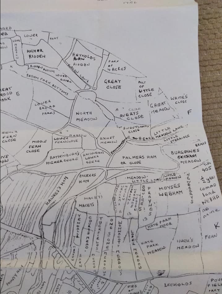
Hog’s Wood (Wonnacotts Meadow) circa 1740s - Jan Goffey’s manual copy
A copy of this ancient map circa 1740, is with the Town Council documents and I was kindly allowed to take a copy for reference.
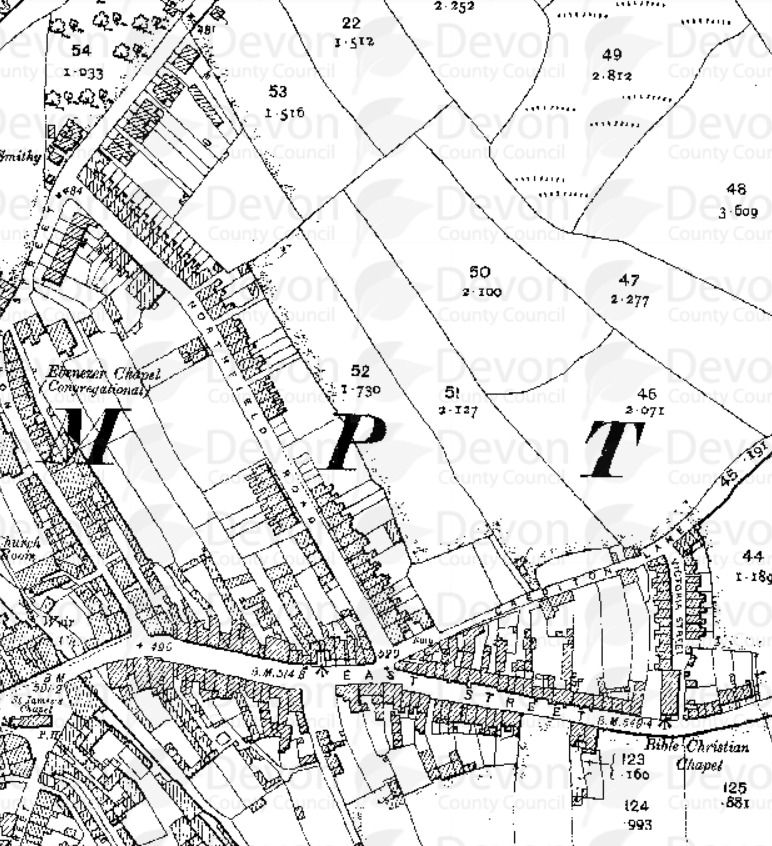
Hog’s Wood in the 1800s
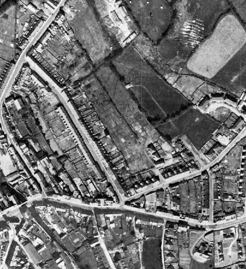
Hog’s Wood in the 1940s with allotments and garages
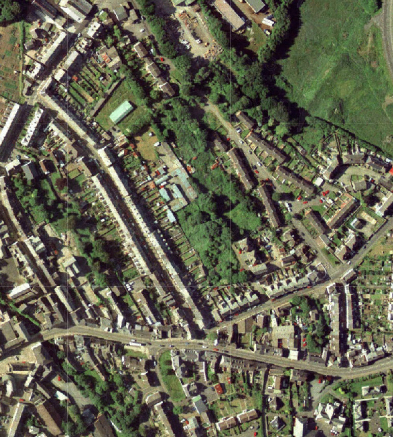
Hog’s Wood woodland in the 2000s
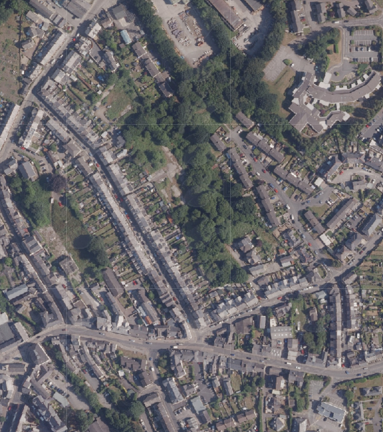
Hog’s Wood diverse woodland with young and mature trees
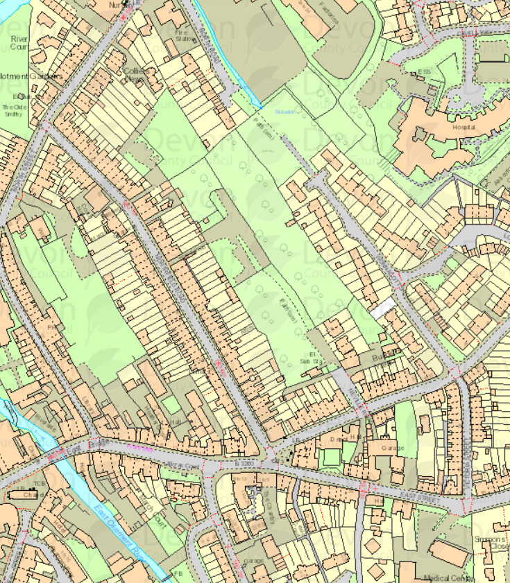
Hog’s Wood - a wild space with connected habitat